Flash Flood Vulnerability of Five U.S. Cities due to Climate Change
Flash Flood Vulnerability of Five U.S. Cities due to Climate Change Heading link
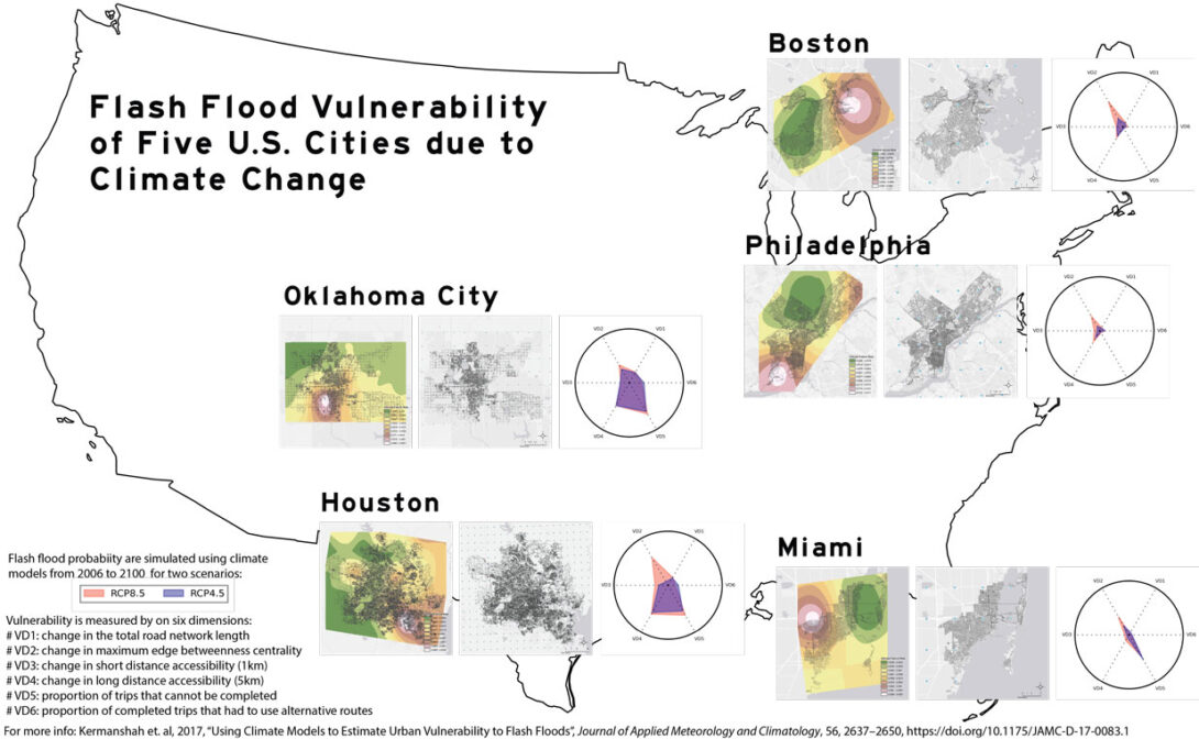
The figure below shows the Vulnerability Surface (VS) of five U.S. cities to flash floods due to climate change. The five cities are: Boston (MA), Houston (TX) that was badly hit with flash floods by Hurricane Harvey in August 2017, Miami (FL) that was significantly affected by Hurricane Irma in September 2017 (although the damage was mainly caused by sea level rise as opposed to flash floods), Oklahoma City (OK), and Philadelphia (PA). The VS are based on six dimensions that capture different element of transport resilience from the change in the total road network length to the change in short distance and long distance accessibility. We can notably see that Houston and Oklahoma City are particularly vulnerable to flash floods. Make sure to click on the picture to get a full resolution. Climate model outputs from 2006 to 2100 for two climate change scenarios were used to estimate future rainfall patterns. The full paper is available in open access format on the site of the Journal of Applied Meteorology and Climatology. The paper includes a detailed description of the method as well as a full discussion of the results.