Impact of Flooding on Chicago Roads
Impact of Flooding on Chicago Roads Heading link
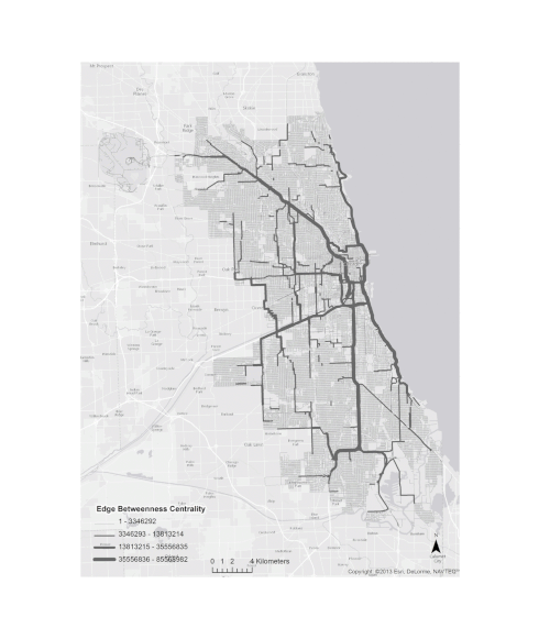
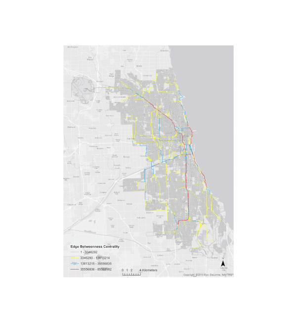
The gif visualizations below (click on picture for full resolution) were produced by CSUN’s Amirhassan Kermanshah. They both show the distribution of edge betweenness centrality before and after a 100-year flood in Chicago, which was simulated by the Federal Emergency Management Authority (FEMA). Edge betweenness represents the likelyhood of a link to be selected in the network to join any two nodes. In our case, we consider all intersections as nodes/vertices and all road segements as links/edges. Because Chicago has several rivers, a flood can potentially divide the city in three disconnected areas, hence the drastic changes in edge betweenness. Note that we tried two versions, one in grayscale but changing the link widths, and the other using colors. Which one do you prefer? This is a simple and yet powerful example to show that the same information can be displaid in many different ways.
Update: We now know that the data that was used is partially incorrect since the raw data had some problems. Make sure to check our GISF2E tool (GIS Features to Edgelist).