Resilience of Illinois Highway Network
Resilience of Illinois Highway Network Heading link
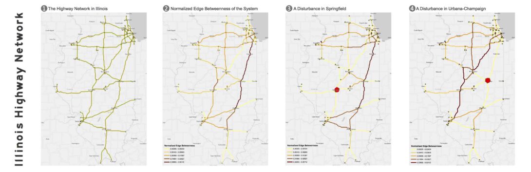
Resilience has become an active area of research in academia, notably because of the severe storms that have happened been in the past decade. Transportation infrastructure is critical, especially in dire conditions to be able to reach areas under stress. The figure below shows the Illinois Highway system (click on the figure for the full pdf). It was nicely design by CSUN’s Amirhassan Kermanshah. We first calculated the edge betweenness of all the links and plotted the results in GIS. Then, we removed important pieces of the network, first Springfield and then Urban-Champaign, and calculated how it affected the distribution of edge betweenness in the system. The changes are quite substantial! Can you guess what we would happen if we remove both Springfield and Urbana-Champaign? We have much more work on the topic in progress, and we hope to share more soon.