GIS F2E – GIS Features to Edge List Tool (2D and 3D OSM version)
GIS F2E – GIS Features to Edge List Tool (2D and 3D OSM version)
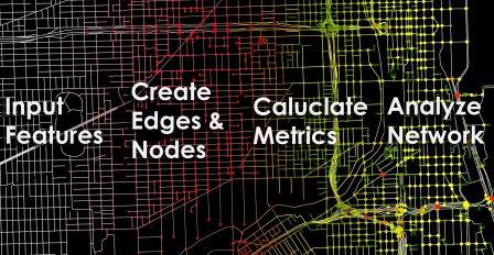
The GIS Features to Edge List (GIS F2E) tool allows anyone who uses GIS data (i.e., shapefiles) to export a feature (e.g., polylines) as a network; whether you are working with streets, pipelines, electric wires or just about any interconnected linear features. We have three versions of GIS F2E: (1) ArcGIS, (2) python, (3) QGIS. The tools can be run in two ways. The first way is standard, and two lines crossing automatically create a node. The second way specifically processes openstreetmap (OSM) road data, and it accounts for bridges and tunnels, not to artificially create non-existing nodes and edges. Each version of the tool comes with a tutorial. The tools create two new GIS layers, one with all nodes and one with all edges, and the edge list is in .csv format. An edge list is a list of all links/edges in the network with start node ID, end node ID, and edge ID). The edge list can then be imported by any program, such as R or Python (e.g., using igraph or NetworkX), Gephi, or NodeXL (Excel Add-On) to name a few. We have applied the OSM model to 80 cities in the world, and the data can be directly downloaded here. For citation, please use Karduni, A., Kermanshah, A., Derrible, S., (2016) A protocol to convert spatial polyline data to network formats and applications to world urban road networks. Scientific Data, 3:160046, doi:10.1038/sdata.2016.46, available here. See our publication page for full details.
ArcGIS
version 2.10: Download |Tutorial | Publication | Tested with ArcGIS 10.7.1 | Uses arcpy (the Python code is not needed but supplied in the package for your information and is available here).
version 2.00: Download |Tutorial | Publication | Tested with ArcGIS 10.4 , 10.6 | Uses arcpy (the Python code is not needed but supplied in the package for your information and is available here).
version 1.10: Download |Tutorial | Publication | Tested with ArcGIS 10.3, 10.4 | Accounts for changes in openstreetmap data and makes graph undirected
version 1.00: Download |Tutorial | Publication | Tested with ArcGIS 10.3 , 10.4 |
Python
version 1.20: GitHub | Download | Tutorial | Publication tested for Python’s pandas library version 0.19.2
version 1.10: GitHub | Download | Tutorial | Publication tested for Python’s pandas library version 0.18.1
version 1.00: GitHub | Download | Tutorial | Publication tested for Python’s pandas library version 0.14.1
QGIS
version 1.20: GitHub | Download | Tutorial | Publication tested for Python’s pandas library version 0.19.2
version 1.10: GitHub | Download | Tutorial | Publication tested for Python’s pandas library version 0.18.1
version 1.00: GitHub | Download | Tutorial | Publication tested for Python’s pandas library version 0.14.1
GIS F2E – GIS Features to Edge List Tool (2D and 3D OSM version)

.