World Metro Networks Poster
World Metro Networks Poster Heading link
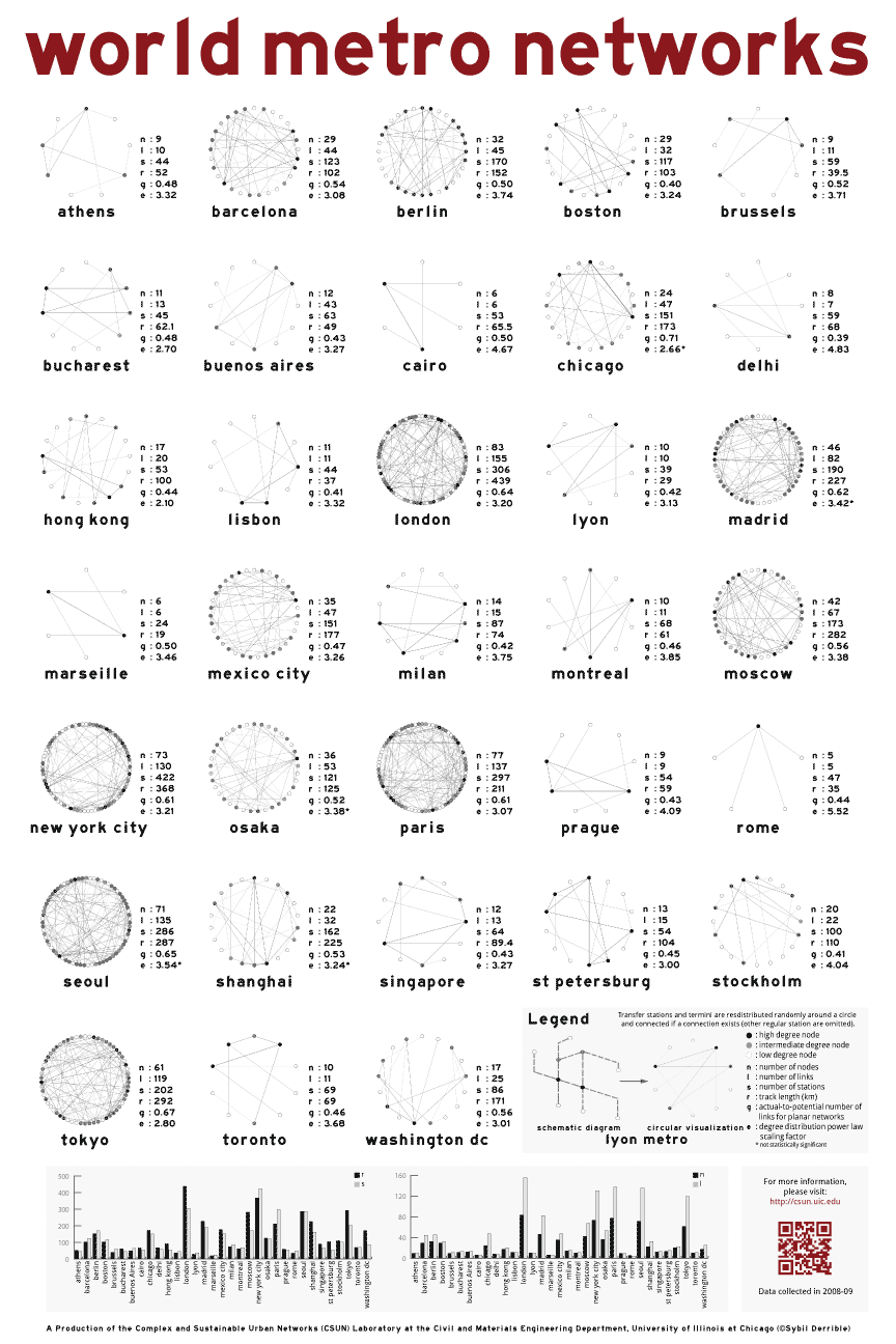
The poster below (full 4.5MB) shows a circular representation of 33 metro networks in the world (only the termini and transfer stations are shown). You can notably see the difference between small and large metros (e.g., Prague and Paris). We also included five metrics on the right of each representation: nodes, links, stations, route length, degree of connectivity and scaling factor.
Special thanks goes to my friend and visualization expert Till Nagel for his precious comments.
Feel free to distribute the poster and don’t hesitate to contact me for further information.
Click here to download a high-resolution version of the image below